


Texas Hill Country
To the west of Austin, the eroded remains of the Edwards Plateau lie draped over the landscape of rolling hills. The terrain offers spectacular limestone cliffs, dramatic bluffs, gorges and serene lakes and perhaps a chance to spot white-tailed deer, wild turkeys, armadillos and endangered songbirds which call this area home. Along the route, you will be met with Mexican, Native American, Spanish, Italian and German influences on ranching traditions, architecture, food and winemaking in the region.
Like many of our scenic drives, this route can be done in either direction. We describe it as a counter-clockwise loop that begins just outside of Austin and ends about 45 miles south of Austin and 30 miles north of San Antonio in the town of New Braunfels. From I-35, take exit 230 for US-290 West where the scenic drive will begin in a few miles.
If this is your first time in Austin, there is much to explore. Stop at the Bob Bullock Texas State History Museum (M1) to learn the “Story of Texas” through interactive exhibits. Or visit the Texas State Capitol Building (A1), designed by architect Elijah E. Myers and completed in 1888. The exterior walls are “sunset red” granite, quarried just 50 miles from the site. Austin offers something for everyone. Known as the “Live Music Capital of the World”, take in a concert, shop at the eclectic shops, browse art galleries or dig in to some Texas BBQ. And for a truly fascinating spectacle, don’t miss the Congress Bridge Bats. Each night, from March to November, more than 1.5 million Mexican free-tailed bats emerge from under the Congress Avenue Bridge to forage for food. Get more information and tips on good viewing points from the kiosk east of the bridge.
Leaving the city life behind, distant views of the Edwards Plateau lie ahead. About 19 miles from the start of the drive, the road climbs over the limestone cliffs of the plateau. Once an ancient seabed, the brittle limestone is filled with skeletons, marine fossils and shells.
Hill Country is a popular destination for wildflower enthusiasts and photographers. Beginning in late February/early March and peaking the first weeks of April, bluebonnets, the Texas state flower, as well as Indian paintbrush and evening primrose cover the fields with an explosion of color.
Known as the “Bluebonnet Capital of Texas”, the nearby town of Burnet hosts the Burnet Bluebonnet Festival the second weekend in April. Enjoy family activities, live music, arts and crafts, carnival attractions and more.
Moments after passing the town of Henley, consider a side-trip to Pedernales Falls State Park (H3) by turning right onto Ranch Road 3232. Pedernales Falls State Park (pronounced locally as perd’n-AL-es) was formed when the Llano Uplift created the Edwards Plateau. The limestone ledge now forms a staircase-like cascading waterfall. Explore the beauty and serenity with a hike on the Hill Country Nature Trail. With more than 5,000 acres, the park also offers swimming, tubing, mountain biking trails, wildlife watching and camping.
Back on US-290, the road soon merges with US-281, where this scenic drive continues north. However, if time allows, consider heading south and doing the Devil’s Backbone, a scenic loop through ranches and the Texas Hills.
Heading north on US-281/US-290, you arrive in the town of Johnson where President Lyndon B. Johnson lived as a child. At Lyndon B. Johnson National Historic Park (H4), visit his boyhood home and Johnson Settlement where Lyndon Johnson’s grandfather and great-uncle established cattle droving headquarters. Their log cabin, barns, and windmill still stand. Stop at the visitor center for historical information and video. You can obtain a free driving permit and self-guided CD from the Visitor Center to tour the LBJ Ranch 14 miles away. At LBJ Ranch, visit Lyndon B. Johnson’s reconstructed birth place, the schoolhouse he attended, the Texas White House where his work as president was done while he was vacationing here, and the cemetery where he is buried. Trails allow you to explore the farmlands, nature, and wildlife.
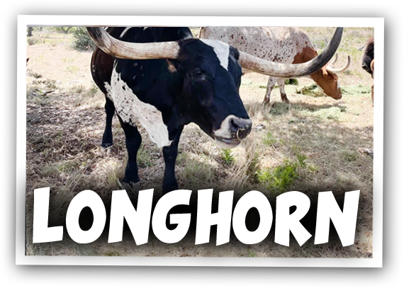
Continuing west along US-290 towards Fredericksburg, you will pass more ranches and fields where deer graze. The Lyndon B. Johnson State Historical Park (H6), is home to a herd of Texas longhorn cattle, adapted for the dry hills and vegetation of Texas. When their populations began to decline, this park was established in 1948 to protect and preserve this historic treasure. The park also is home to the Sauer-Beckmann Farm where you can learn about plowing, churning, and other farming chores from the late 1800s. Park interpreters do the chores and wear period clothing. No entrance fee is required, but donations are accepted.
Heading west, the hills begin to recede and grape vines replace them. Fredericksburg has several homes in the Old World fachwerk (timber and stone) style. If you visit on Easter Sunday, the Easter Fires Pageant remembers a story told by mothers that Native American signal fires were actually the Easter bunny’s fires to prepare the Easter Eggs. Germans were among the first non-native settlers and the city is now an eclectic mix of the Old West with European influences. The city features wine tasting, agritourism, shopping, art galleries and a variety of festivals. Visit the National Museum of the Pacific War (M3), which contains an impressive display of Allied and Japanese aircraft, tanks, guns and other large artifacts made famous during the Pacific War campaigns.
From Fredericksburg, consider an 18-mile side-trip on Farm Road 965 to the Enchanted Rock State Natural Area (H9) which surrounds the billion year old batholith, Enchanted Rock. The pink granite rock emits interesting noises and flashes of lights as it contracts and expands, leading Native Americans to believe that it was possessed by supernatural powers. Equally impressive is the rock’s size, spanning over 70 acres and rising over 400 feet, it is the second largest granite slab in the U.S. Those who hike to the top are rewarded by expansive views of the landscape.
Retracing back down to Fredericksburg, the road now heads south on TX-16, following the curves of the Guadalupe River Valley.
In several miles, you arrive in the town of Kerrville, home to the Museum of Western Art, Hill Country Museum, and Kerrville-Schreiner State Park. The Museum of Western Art (M2) showcases Western American heritage with a rotating selection of sculptures, paintings, and artifacts. The Hill Country Museum (M4) is a beautiful Romanesque mansion filled with the antiques and memorabilia of Captain Charles A. Schreiner. Sitting on the banks of the Guadalupe River is Kerrville-Schreiner State Park (H7), an excellent spot to escape from the heat of summer with a swim, picnic or hike.
From Kerrville, our scenic drive heads west on TX-39. If you are short on time, you can continue south on TX-16 past Medina (“apple capital of Texas”) to Bandera, but you will miss out on some of the best twisties of this scenic drive.
Heading west on TX-39, enjoy the twists of the South Fork Guadalupe River. As you approach the town of Hunt, keep to the left to stay on TX-39 and you will be rewarded with a series of hairpin turns and rollercoaster roads with spectacular scenery of craggy canyons and crystal clear streams.
In 20-miles from the fork, turn left onto Farm Road 187. In 11-miles, Lost Maples State Natural Area (H8) is on your right. Several groves of bigtooth maples still stand from a time when the climate was much cooler and moister, protected in canyons from the wind and heat. The fall foliage here is a spectacular sight — and very popular. Parking is limited so if possible, visit during the week. Wildlife abounds with gray fox, white-tailed deer, armadillo, raccoon, bobcat and javelina and the park is a bird watchers paradise, featuring over 300 species including the endangered black-capped vireos and golden-cheeked warblers. There are a few hiking trails to absorb the incredible, rugged scenery.
Back on Farm Road 187, continue south until a few miles before Vanderpool, where Farm Road 337 heads west towards Leakey for some more twisties through oak ridges and panoramic views of the Frio and Sabinal River Gorges.
From Leakey, turn south (left) onto US-83 for a few miles (or take Farm Road 1120) which will lead you to Farm Road 1050. Just south of here is Garner State Park (H10) where you can enjoy the spring-fed clear waters of Frio River. A popular vacation destination, the park delights with swimming, tubing, kayaking, nature study, camping and more.
Heading east on Farm Road 1050, you arrive in the town of Utopia, a historic ranching community from the early 1850s. From here, turn left onto Farm Road 187 through the town, and then a right on Farm Road 470 which brings you to TX-16 along a beautiful, winding roads along hills, juniper, and oaks.
As you merge onto TX-16, continue east and you arrive in Bandera, the “Cowboy Capital of the World.” The Frontier Times Museum (M5) is a monument to Pioneer days, with an art gallery, western artifacts and even a shrunken head.
Continuing east on TX-16 for 10-miles, you descend from the Edwards Plateau and Texas Hill Country becomes a speck in the distance. Arriving at the TX-46 intersection, turn right onto it to continue this drive. If you are heading to San Antonio, the TX-16 will bring you right into the heart of the city.
After crossing I-10, you pass the town of Boerne, known for its antique stores and the Cibolo Nature Center (H11) which features 100 acres of Texas Hill Country accessible by trails to explore its four distinct ecosystems: riparian forest, live oak savannah, tall-grass prairie and spring-fed marsh.
Continuing east on TX-46, you will pass State Park Road P31 in 13 miles. A 3-mile side trip will bring you to the Guadalupe River State Park (H12). Close to the larger cities of San Antonio and Austin, in this recreation wonderland you will feel a world away. Enjoy picnics, swimming, hiking, boating, fishing, equestrian trails, camping and more along the Guadalupe River lined with huge bald cypress trees. Guadalupe River is also a top tubing destination. There’s nothing better on a hot summer day than a cool river float trip. Nearby Honey Creek State Natural Area (H13) offers a chance to venture into pristine nature only accessible with a two-hour guided tour Saturdays at 9:00am. Call the park to reserve.
Back on TX-46, the scenic drive continues east. In a few miles, you will past US-281 where a short drive north will bring you to a side-trip on the Devil’s Backbone.
The drive continues through rolling hills with cedar and oak trees lining the road until arrive in the town of New Braunfels, the oldest community in Texas and the scenic drive comes to an end. Explore museums, shops, dining and more water recreation on Canyon Lake State Park (W2) as well as the less natural but lots of fun, Schlitterbahn Waterpark Resort. Visit the Gruene Historic District, on the National Register of Historic Places, to stroll by the charming 19th-century German-style homes and shops. And don’t miss the Gruene Hall (A3). Built in 1878, it is the oldest continuously operated dance and music hall and the focal point of the Central Texas entertainment scene.